May 25: Central Kansas Supercells
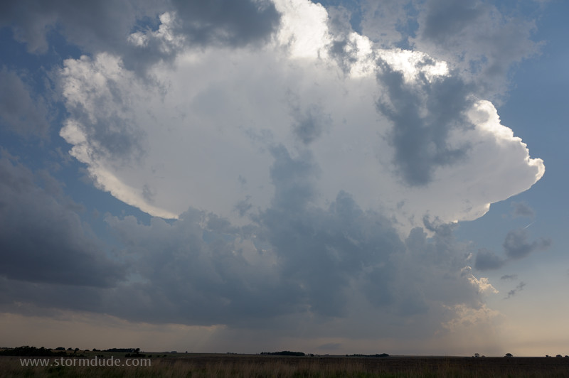
Strong convection near triple point on a hot afternoon in central Kansas.
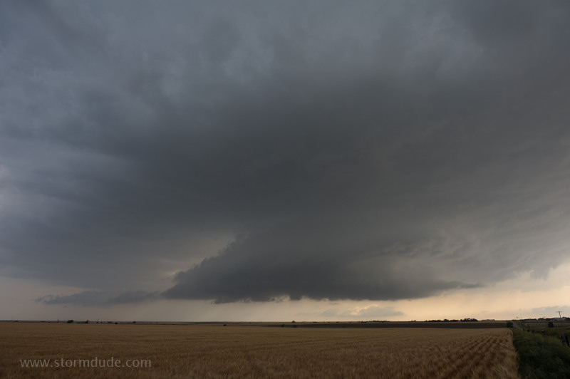
Wall cloud southeast of Hays.
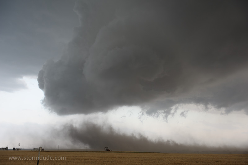
Storm stirs up dust cloud from a freshly plowed field.
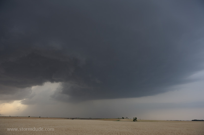
Cell weakens as convection develops back to the southwest.
Wall cloud over Russell, Kansas.
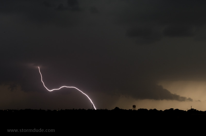
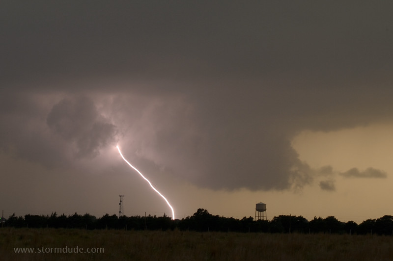
Storm provides lightning show as dusk approaches.
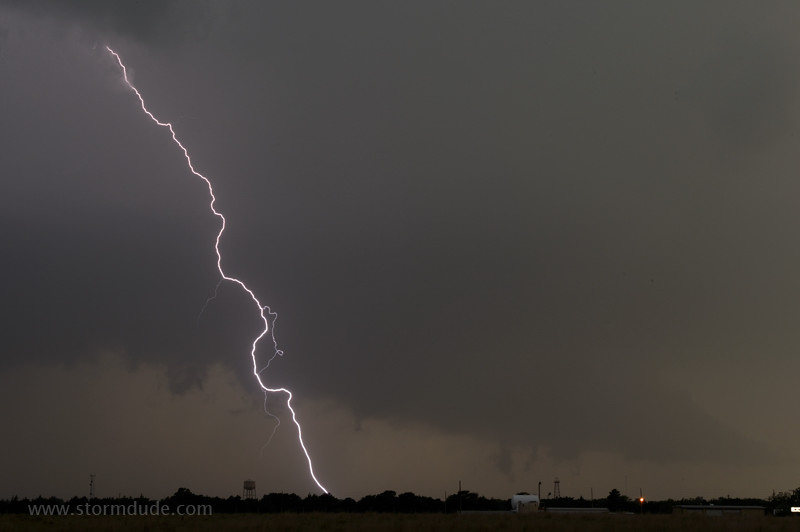
Frequent CGs (cloud-to-ground strikes) continue for twenty minutes over the town.
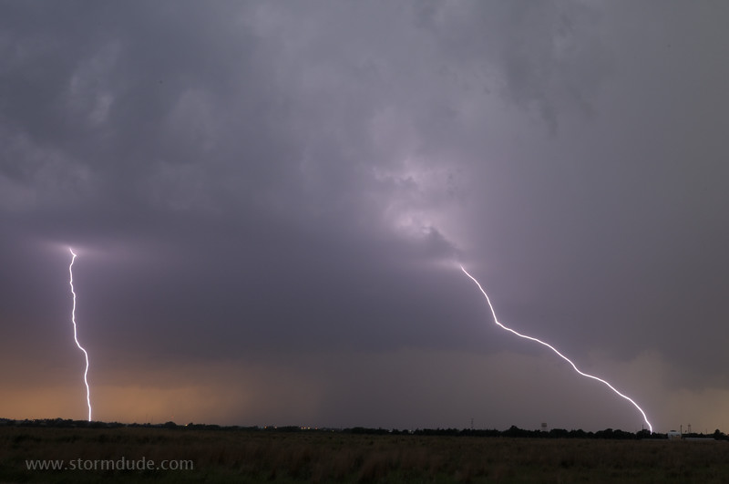
One last photo before I head south to intercept another wall cloud.
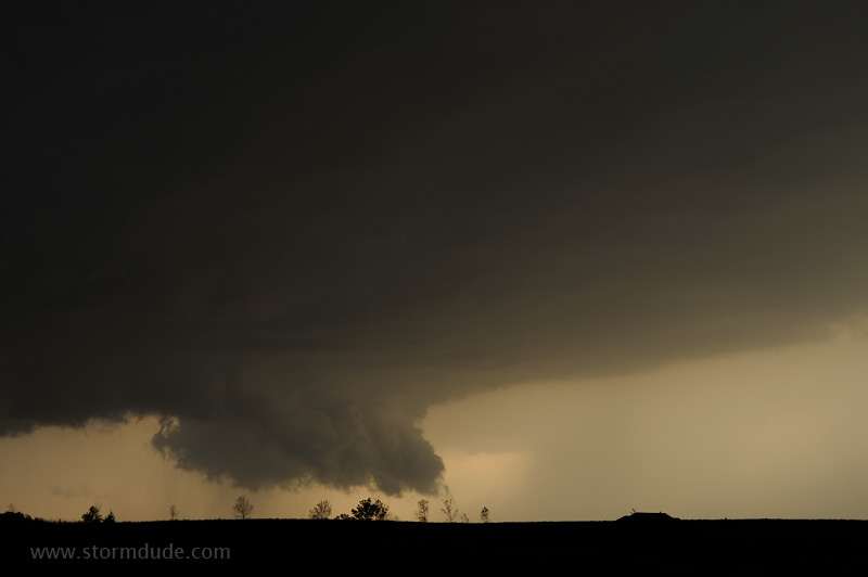
Rotating wall cloud south of Russell.
Primed to produce a tornado.
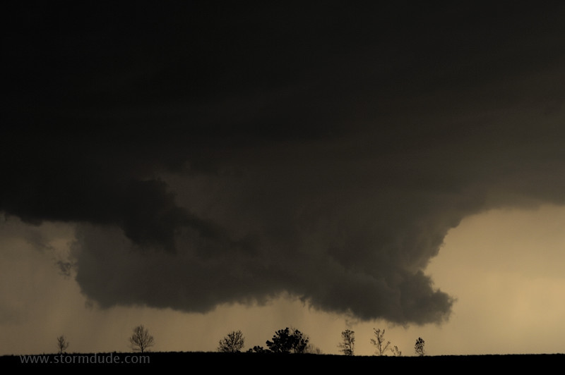
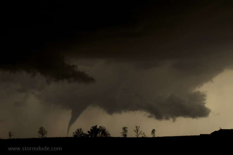
Funnels descends at 8:45 pm.
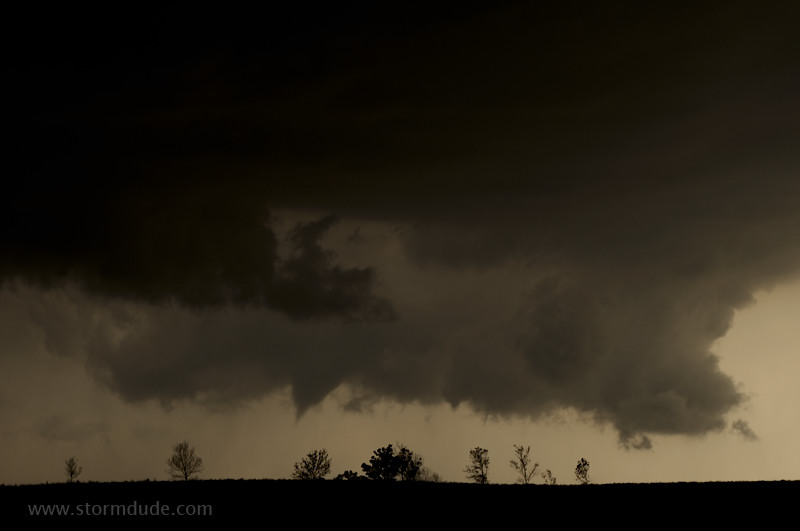
Nearly to the ground.
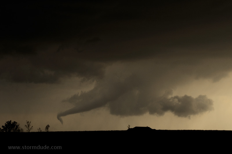
Surreal sight in the fading light.
Tornado weakens as the wall cloud moves north.
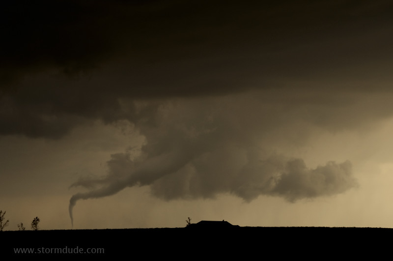
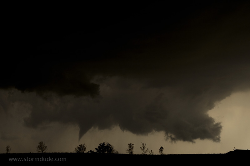
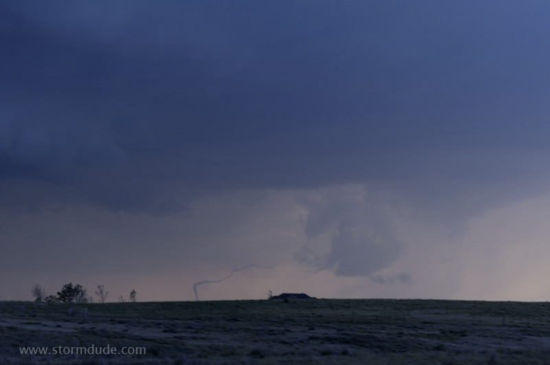
Condensation funnel reaches back to the ground.
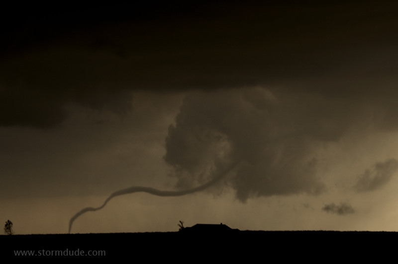
Tornado stretches into long rope.
Lightning illuminates the landscape as the tornado dissipates.